The most promising place to drill at LGX Energy's Ashborough prospect was a dry hole. The company learned that before it spent a well finding out the hard way.
Two-dimensional seismic had read Ashborough as one solid structure, with the obvious target sitting at its center. Three-dimensional seismic showed something else: not one prospect but three, arranged like the points of a triangle, with an empty gap in the middle. The 2D pick sat right in that dead center. "We're gonna have three successful fields instead of one dry hole," is how Executive Chairman Howard Crosby describes the result.
That gap, between what the older data suggested and what the sharper image revealed, is the reason LGX images the ground before it drills.
The Benefits of 3D Seismic
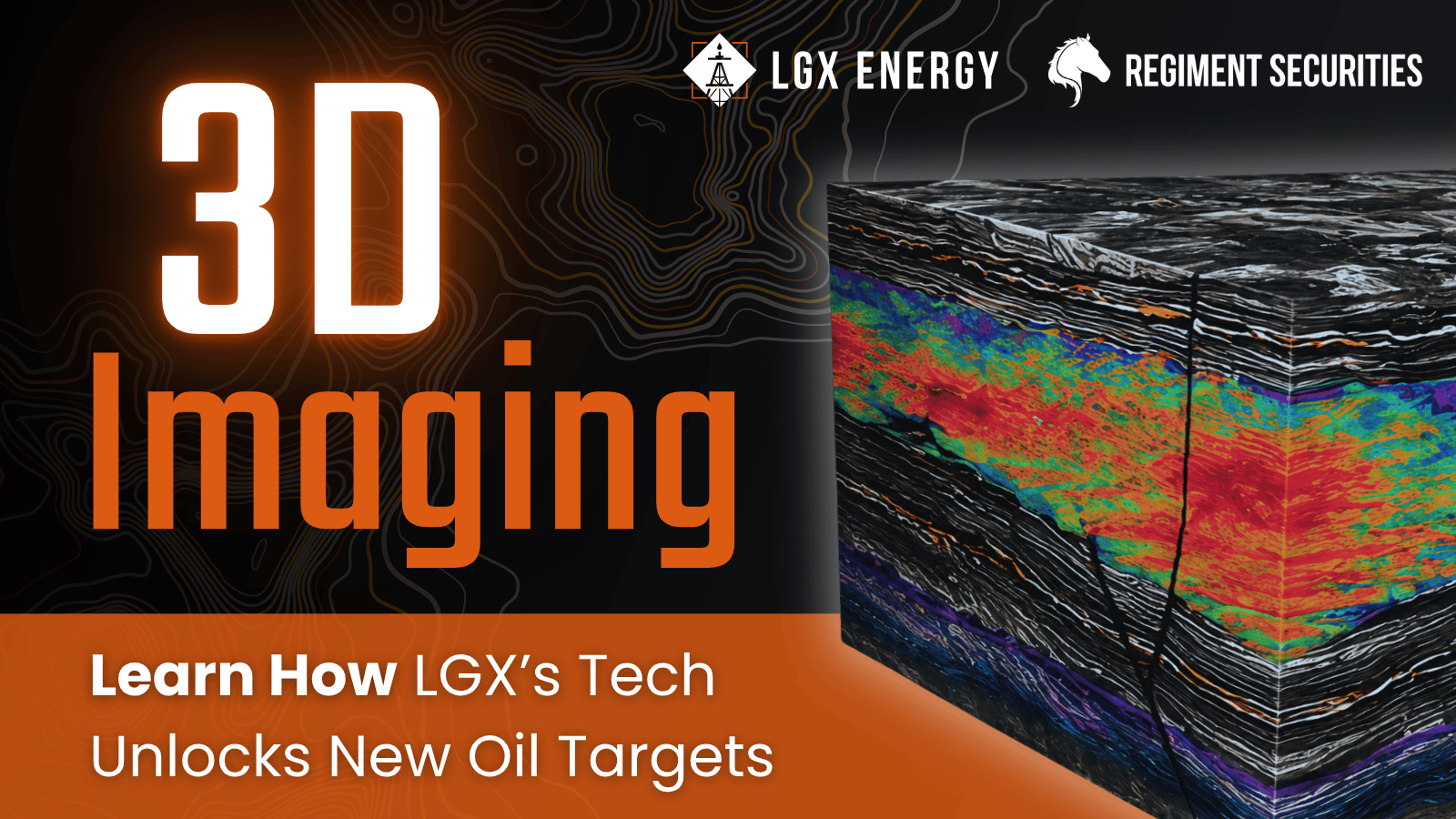
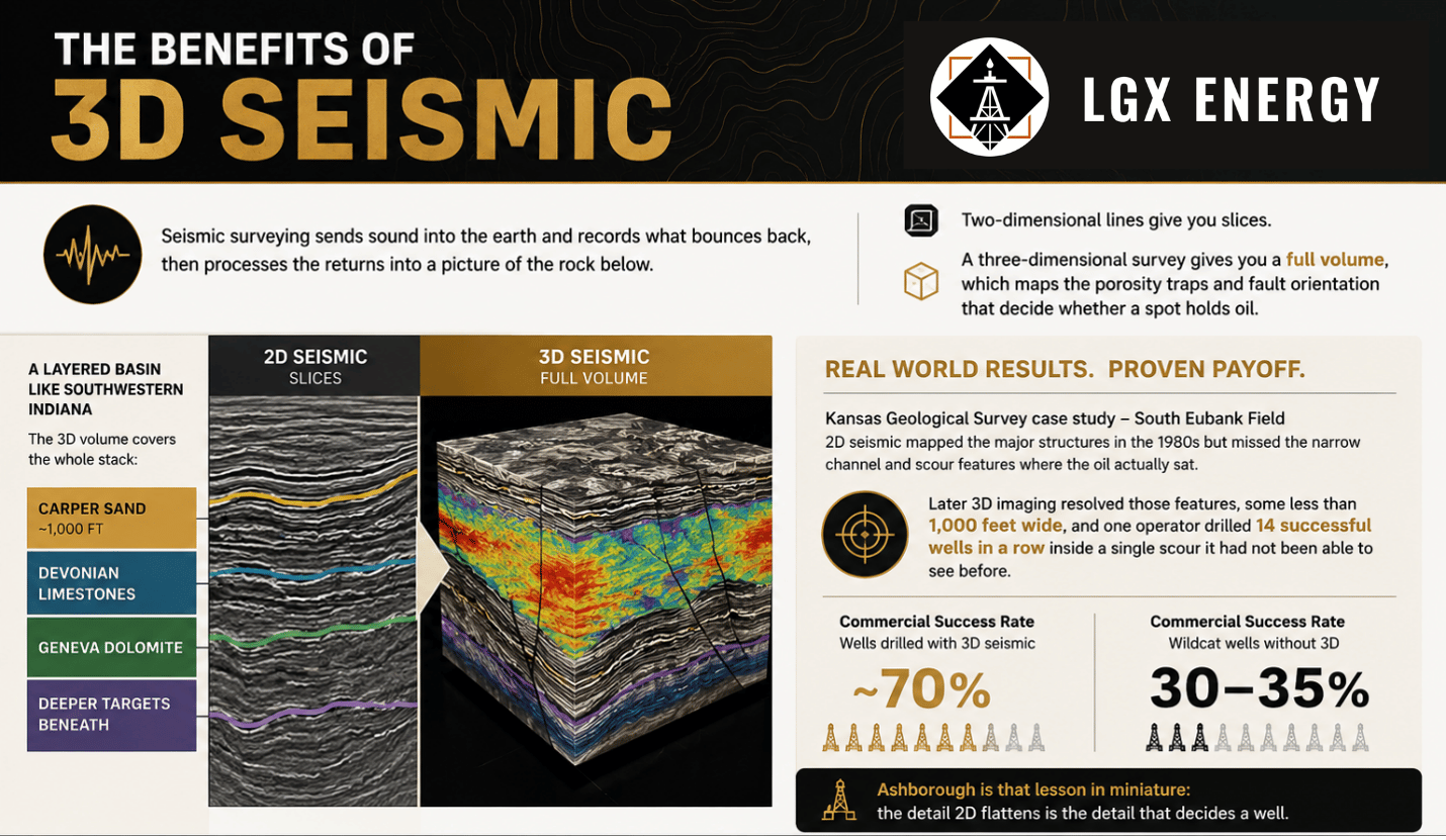
Seismic surveying sends sound waves into the earth and records the reflections that bounce back, then processes the returns into a picture of the rock below. Two-dimensional lines give you slices. A three-dimensional survey gives you a full volume, which maps the porosity traps and fault orientation that decide whether a spot holds oil. In a layered basin like southwestern Indiana, that volume covers the whole stack: the Carper Sand near a thousand feet, the Devonian limestones below it, the Geneva Dolomite, and deeper targets under those.1
The payoff is resolution, and there is a documented record of what it finds. In a Kansas Geological Survey case study, 2D seismic mapped the major structures of the South Eubank Field in the 1980s but missed the narrow channel and scour features where the oil sat. Later 3D imaging resolved those features, some less than 1,000 feet wide, and one operator drilled 14 successful wells in a row inside a single scour it had not been able to see before.2 The same study estimated a commercial success rate near 70 percent for wells drilled with 3D, against 30 to 35 percent for wildcat wells drilled without it.2 The Ashborough prospect is that lesson in miniature: the detail 2D maps is the detail that decides a well.
Those figures come from other operators in another state. They describe what the technology has done elsewhere, not what LGX will do, and they do not indicate the result of any LGX well. Seismic lowers the uncertainty about where oil sits. It does not guarantee that a well produces. Reaching a promising structure and pulling oil from it remain two different things.
Faster and Cheaper Than It Used to Be
The technology shifted the economics. Crosby describes shooting 3D twenty years ago as an ordeal: crews stringing wires across the countryside, permission gathered from every landowner, geophones wired into place, and processing that took three or four months to come back. The cost matched the effort.
Wireless equipment changed that. Battery-powered nodes replace the cabling, crews drop them by hand, and the data returns in a fraction of the old time. By Crosby's account, a survey covering one square mile that ran roughly $125,000 or more a decade ago now comes in under $50,000, with results back quickly and with much improved images. The broader industry has moved the same way. Nodal systems have cut the per-channel cost of a survey to a fraction of cable-based rigs and removed the daily troubleshooting that cable theft and damage used to force on a crew.3
The Ashborough Example, in Full
The 2D data was not useless. It gave LGX a roadmap and marked Ashborough as worth a closer look. On those lines, the prospect reads as one good structure. Drilling on that read alone would have put a well into the empty center of what turned out to be a three-part feature.
The confirmation 3D survey resolved it into three separate structures with a barren gap between them. One dry hole became three targets. That is the case for shooting 3D over a promising 2D lead before committing a well, and it is how LGX now works its inventory: image first, drill second.
First to Bring It Here
LGX's edge is timing. It is the first operator to apply this confirmation-3D approach across this corner of the Illinois Basin, and it has four years of processed seismic, signed leases, and field knowledge behind it. A competitor starting now would need to rebuild all of that before drilling a single confirmed prospect. That head start is the hardest part to copy in a hurry.
What It Means if You Are Weighing the Offering
Better imaging is a tool, not a forecast. It improves how LGX chooses where to drill; it does not promise what any well returns. LGX Energy is conducting a private placement, supported by Regiment Securities, available only to verified accredited investors. The investment is speculative and illiquid, and a complete loss of principal is possible. If the approach interests you, read the offering documents, including the risk factors, and decide for yourself.
Footnotes
- Reservoir and formation detail for southwestern Indiana, Indiana Department of Natural Resources, Division of Oil & Gas, and Kansas Geological Survey / AAPG (2003): the Devonian Muscatatuck Group (North Vernon, Jeffersonville, Geneva) and reservoir depths generally 1,000 to 3,000 feet. in.gov/dnr/oil-and-gas/files/og-OilGas_in_Indiana.pdf
- "3-D Seismic Applications" case study, Kansas Geological Survey / PTTC: 3D imaging resolved channel and scour features under 1,000 feet wide that 2D missed at the South Eubank Field, one operator drilled 14 successful wells within a single scour feature, and the study estimated a commercial success rate near 70 percent for wells drilled with 3D versus 30 to 35 percent for wildcat wells drilled without it. kgs.ku.edu/PTTC/Case_Studies/PTTCseismic_case/3d-seismic_appl.pdf
- "Nodal technology enables faster, cheaper, and safer onshore exploration," STRYDE: wireless nodal seismic systems cut per-channel survey cost to a fraction of cable-based systems and remove the cabling, line checks, and downtime of older rigs. stryde.io/blog/nodal-technology-enables-faster-cheaper-and-safer-onshore-exploration